When I was young, like many children of Hebburn’s Catholic families I attended St. Aloysius’ Infant School on Argyle Street. At the time, the school must not have had its own kitchen facilities, because I can remember the food for the school lunches being delivered in big metal containers out of a van. They didn’t look very appetising, but luckily my Nana was able to pick me up every day and take me to her flat for lunch.
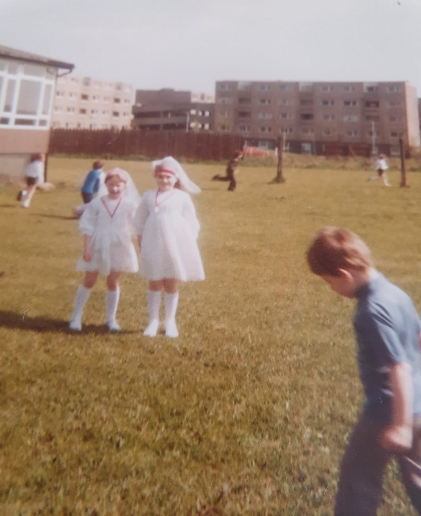
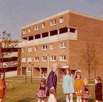
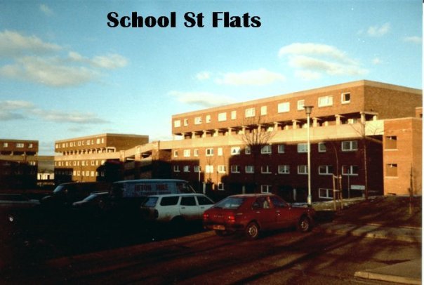
My Nana lived at 35, Hardie Court in the School Street Flats, which were a short walk along Argyle Street from St. Aloysius Infants. In fact, looking at old photographs I am surprised by just how close some of the blocks were to the school. The photograph below shows children at their First Holy Communion at the school, with the flats visible in the background.
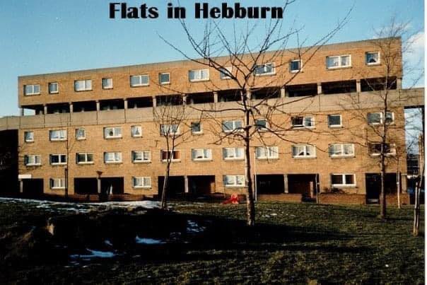
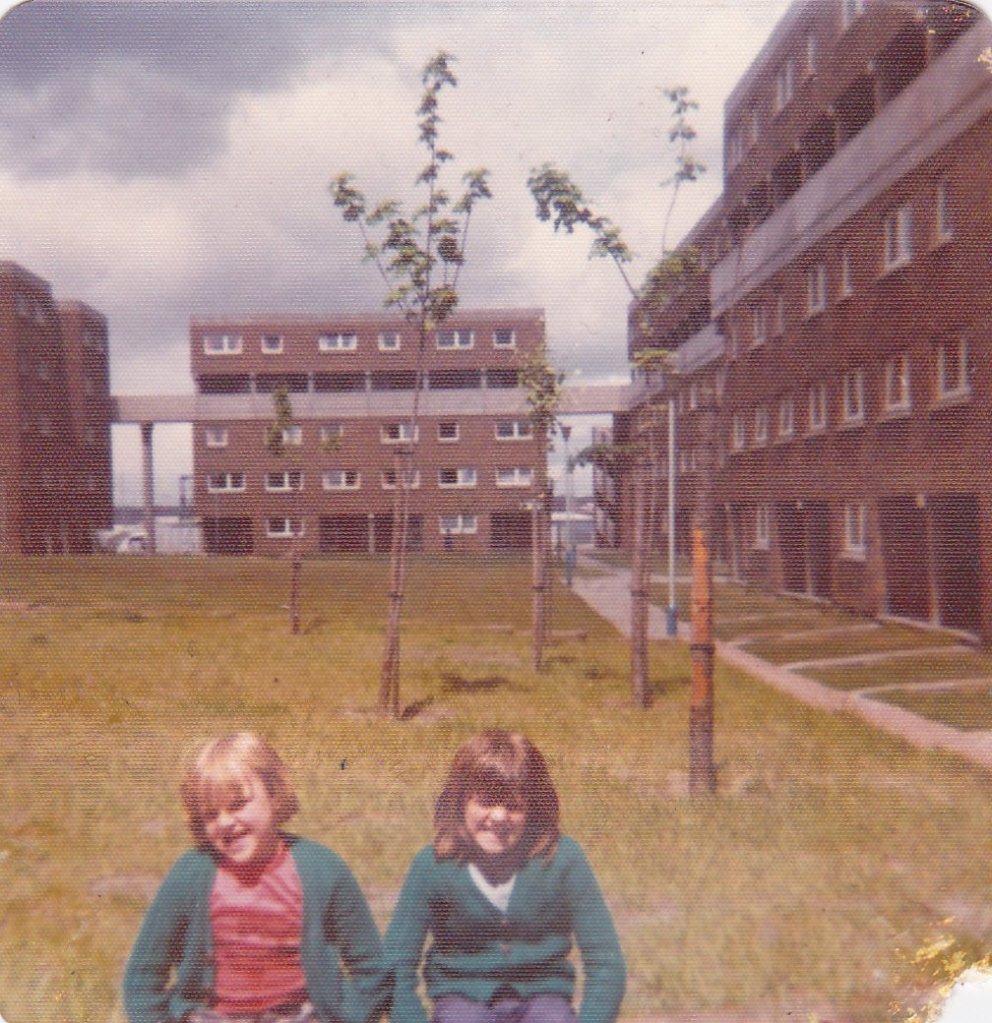
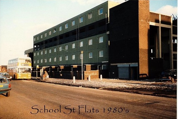
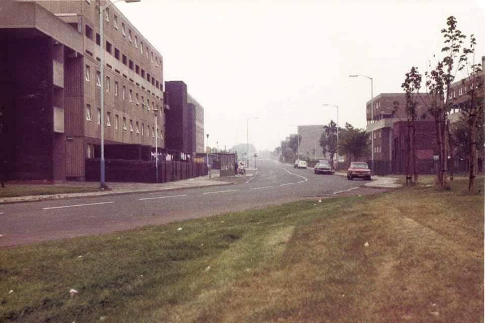
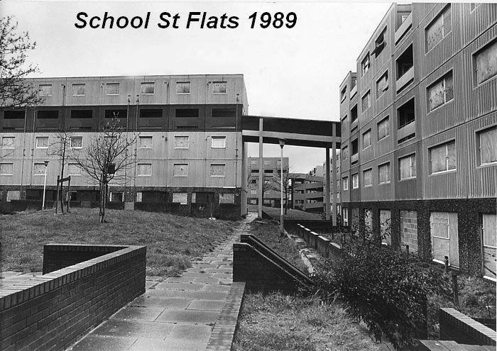
The School Street flats were built in the 1960s in the Brutalist architectural style that was popular then. The blocks of flats, connected by concrete ramps and walkways, surrounded green spaces with paths leading between blocks. On the grass were some of those sandstone boulders that were all over Hebburn back then and originally came from the Lakes area.
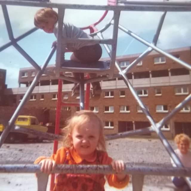
There was at least one play park with a climbing frame and swings, and possibly a football pitch at one time. I also seem to recall some shops being on the ground floor of one of the blocks, and a shed or building of some sort that was used to store equipment that children used to play with. I have a vague recollection of children playing with barrels, rolling in them and so on.
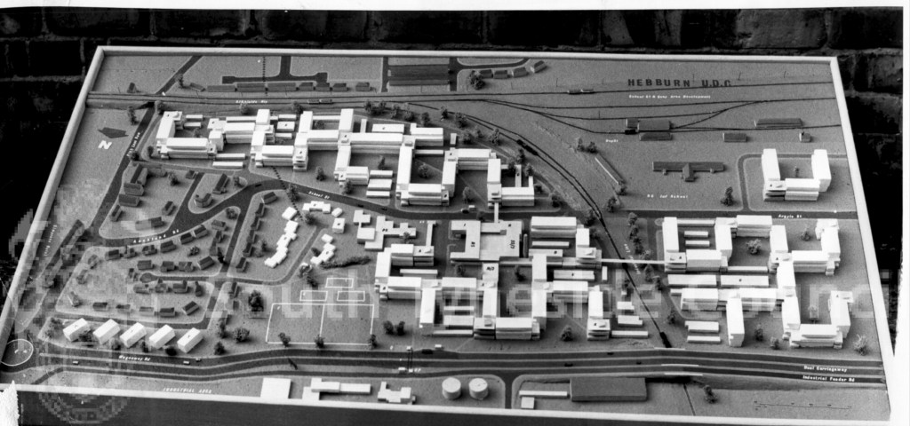
Here is a photograph from September 1964 showing the original proposed layout for the flats and surrounding area. Notice the elevated walkways that cross over the street and railway line. These are reminiscent of the walkways that T. Dan Smith planned for the city of Newcastle.
Thirteen blocks were built in total, all named after Labour politicians (the links go to their Wikipedia pages):
Attlee Court
Bevan Court
Bondfield Court
Dalton Court
Ellen Wilkinson Court
Gaitskell Court
Hardie Court
Lansbury Court
Maxton Court
Morrison Court
Shinwell Court
Summerskill Court
Wilson Court
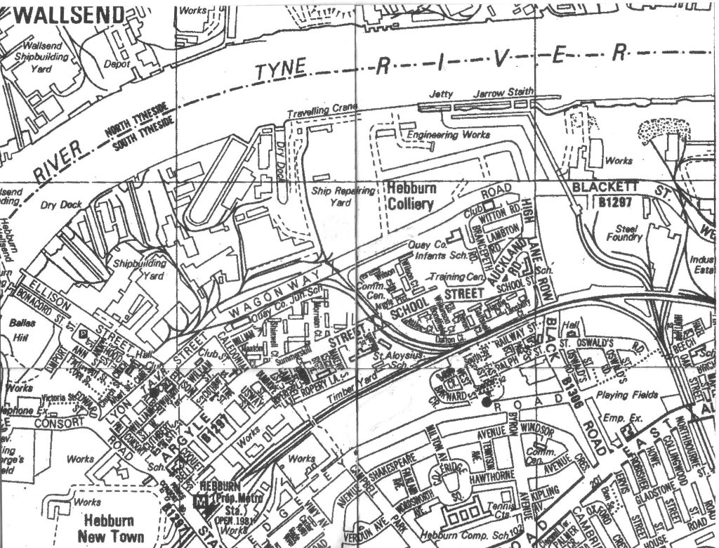
This map shows the location of the blocks along Argyle and School Streets:
I can remember walking into the Hardie Court building and then up a couple of ramps to get to the flat itself. On the landing of the ramp, there was a hatch that you could use to dump your rubbish into the big bins on the ground floor.
When you came in through the door of the flat, there was a little landing, from which you descended a flight of stairs to get to the flat itself. It was a one-bedroom flat, and the kitchen and bedroom looked out over the street while the living room looked out on a green area at the back of the building. I remember it being a nice little flat, small but not cramped.
From the kitchen window you could see all the way down to the river, because we were on the second or third floor. I remember being able to see the many cranes towering over the river; the biggest of them had the letters “NEM” on it in white paint, and I remember being told that it stood for “North Eastern Marine”.
I remember also being able to see Greenfields special needs school from the kitchen window and watching the children playing on the grass during their lunch break. There was one girl who, if she wasn’t held on to tightly by the attendants, would run around and thump the other children!
I also used to like watching the traffic going by on the street, and was especially interested in the Mobile Shop, which was a pink van that used to go around the streets, stopping in various places so people could buy a limited range of groceries. Could that have been Sheldon’s Mobile Shop? The name is in my mind for some reason.
Could the mobile shop have been where my nana bought the iced buns (“icening buns”, I think she called them?), which were shaped like a hot-dog bun but were sweet and had a strip of white icing on the top? I used to love those.
I remember one day a horse and cart going down the street with a load of potatoes on the back. It went over a bump in the road and some potatoes fell off the back of the cart. The cart just kept going as the driver didn’t notice, but sharp-eyed women came running out of the ground floor flats to pick the potatoes up and bring them inside. I can’t imagine people doing that nowadays; it just shows how much less we had back then, that it was worth going outside to scavenge dropped potatoes.
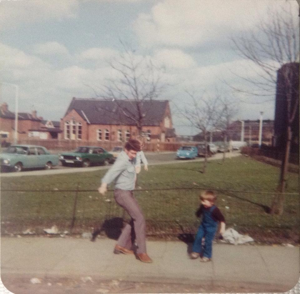
It’s also interesting to remember that horses and carts were still a fairly common sight in the early 1970s, as there was a lot less traffic on the roads in those days. The ragman and the coal man both used horse-drawn carts when I was young. I also remember often seeing the blue, single seater “Invacars” that were used by disabled people in those days, and which would certainly not be safe to drive in today’s traffic conditions. You can see an Invacar parked on the side of the road in the image below:
After I had eaten my lunch there might be time to watch television in the living room on my nana’s black and white Rediffusion set. You changed the channels on this TV set by rotating a knob on a wall-mounted box. It gave you the choice of BBC1, BBC2, Tyne Tees and a handful of radio stations, which obviously had no picture. There was usually a children’s programme on TV at lunchtime.
I have a memory of the theme music from “Crown Court” signifying that it was time to go back to school, but looking at the TV Times from that era it looks as though it was on too late for that to be true, so it might be a false memory. After lunch my nana would walk me back to school for the afternoon session.
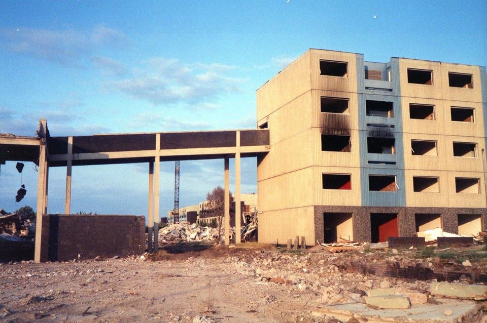
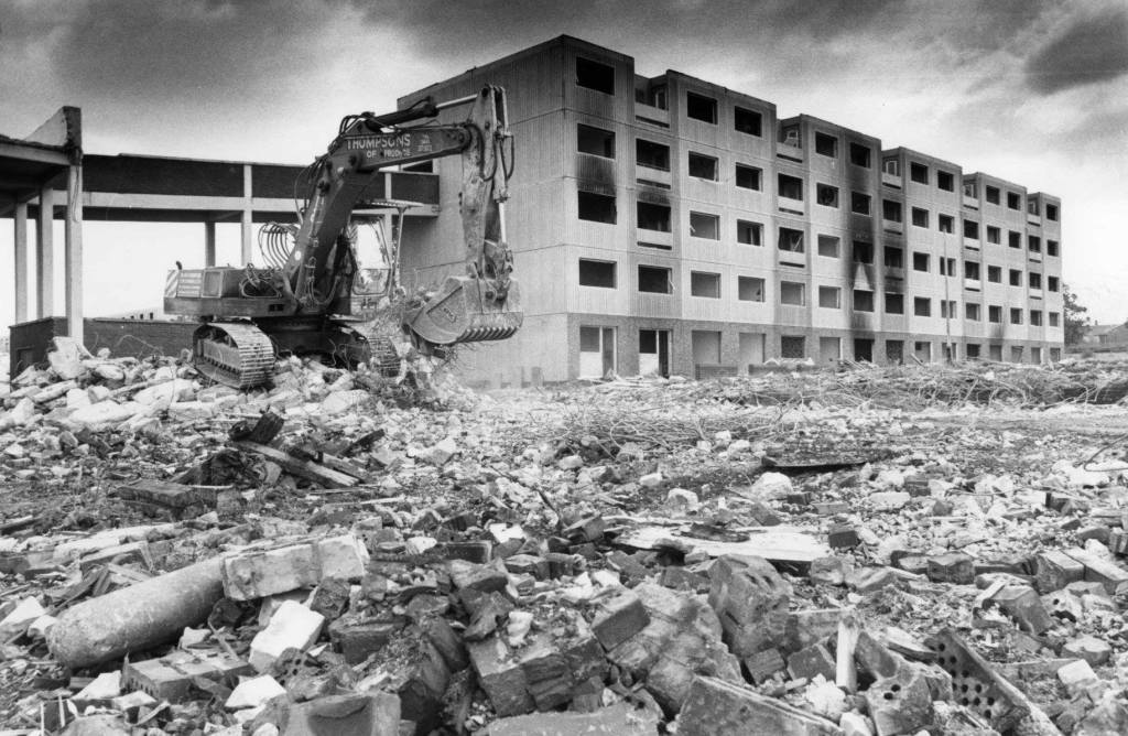
Like many of the Council blocks in Hebburn, the School Street Flats didn’t have a long life. By the mid-1980s they were scheduled for demolition and the residents were relocated. The last of the blocks was bulldozed in 1989.
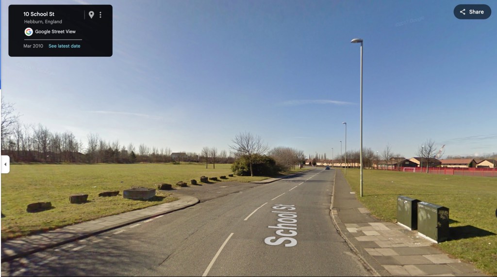
The land that used to contain the School Street flats lay empty for many years. The image below from Google Maps shows the area in March 2010. All that remains of the old flats is the sandstone boulders from the Lakes that used to decorate the green spaces:
More recently however, as is the case in much of Hebburn, the construction of new houses has completely transformed the area. This Google Maps photo from 2024 shows the area as completely unrecognisable from the area I used to visit with my nana:
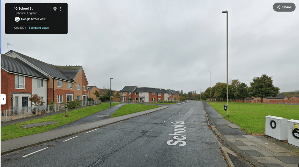
Like all towns and cities, the face of Hebburn is constantly changing. At some point in the future, these brand new houses will doubtless be some future resident’s fading memories, just as the concrete blocks of the School Street flats are mine.

Leave a comment