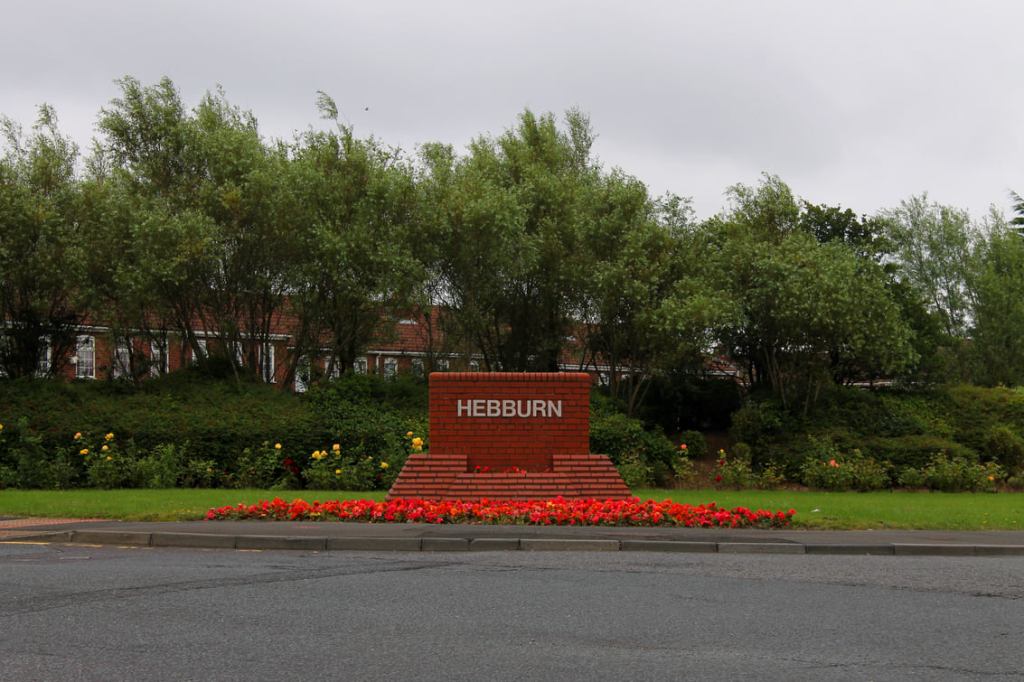
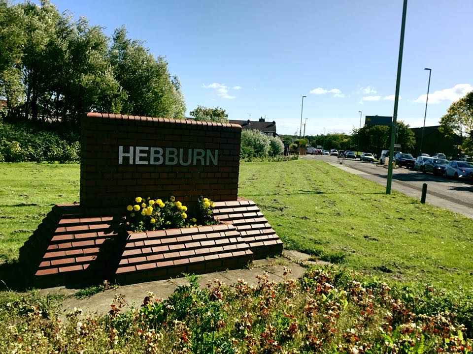
If you were born after about 1982, St. Joseph’s Court will have always occupied the corner of Mill Lane and Victoria Road West in your memories. Here is a photograph of how that corner looks today:
When I was growing up, the view was rather different, as that corner was the site of a covered underground reservoir, built about a hundred years before St. Joseph’s Court. The reservoir was capable of holding two million gallons of water. Like many landmarks from my childhood, photographs of the Reservoir are hard to come by, but here is a photograph from 1937 showing the reservoir and the area around it:
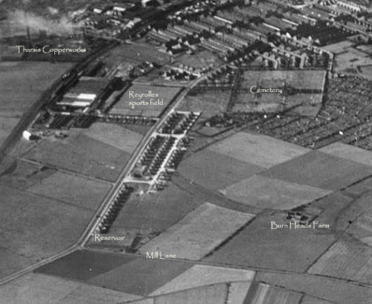
As you can see in the image above, much of the housing in that area (including the house I grew up in) was yet to be built, but the hill shape of the reservoir can be clearly seen. Imagine how it must have looked when the reservoir was built, with no houses around and the area mostly farmland. People of my parents’ and grandparents’ generations would often refer to Mill Lane as “The Waterworks Road” because of the reservoir.
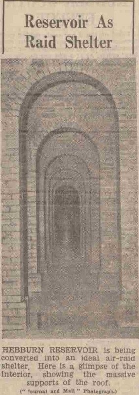
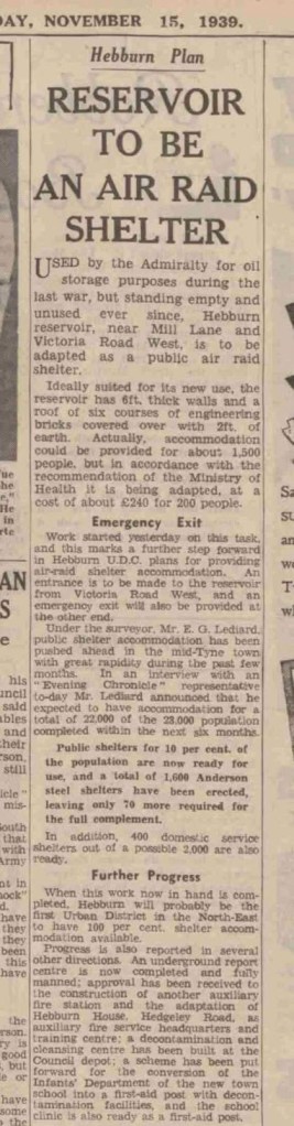
During World War II, the reservoir was drained and used as an air-raid shelter. Here are some newspaper articles from that time about the conversion into a shelter:
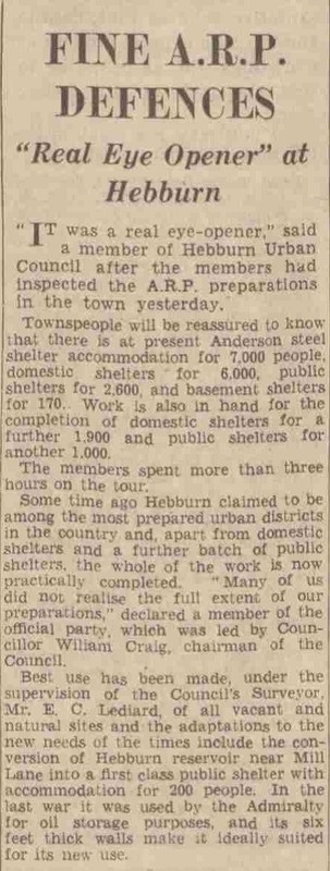
This article details the plan to convert the reservoir to an air raid shelter, and mentions its use for oil storage during World War I and that it had been unused since then:
The article below details the construction of the air-raid shelter and again mentions that the reservoir was used for the storage of oil during World War I:
The reservoir presumably fell into disuse after the war and became derelict, leading to its eventual demolition. This photograph from the mid-1960s shows the reservoir in the context of the surrounding streets. It is opposite the Fire Station, at the junction of Mill Lane and Victoria Road West in the centre of the photograph:
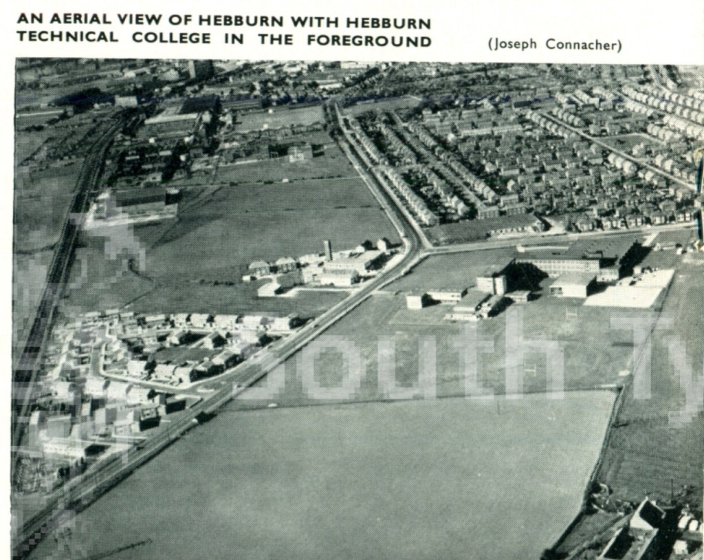
This was pretty much how the area looked when I was a child, except the Clothier Electrical Testing Lab on Victoria Road West has not been built yet in the picture above. It is interesting to note that the house numbering on the east side of Mill Lane today starts with number 4. There was, at one time, a service property associated with the reservoir that would have been number 2. It may have been a pump house and/or a caretaker’s home. Some people have recalled a tiled floor being visible on the site after the property was demolished. Also, you can see in this photograph that it looks like some sort of early demolition might be taking place on the Mill Lane side.
I remember the Reservoir as looking like a concrete ziggurat or some other ancient monument, with its sloping sides leading up to a flat top. There was at least one set of concrete steps leading up to the top of the structure where, on the Mill Lane side, there was a little brick building with an iron-barred gate. This building had stairs leading down to the interior of the reservoir. At some point, the bars of the gate were bent, and I have heard that it became a popular dare for older children to squeeze in between the bars, go down the stairs and walk through the reservoir to another iron door on Victoria Road West. This one couldn’t be opened, but they would stick their arms through the bars to wave to their friends and prove they were there before walking all the way back to the other gate.
I was too young for such derring-do, but I do remember climbing up the steps with an older neighbour and walking around on the top of the reservoir. There were circular grilles set into the concrete, and I used to like dropping pebbles through the grille and waiting to hear them hit the water (or possibly the concrete) below. I remember that I used to call these grilles the “long way downs”.
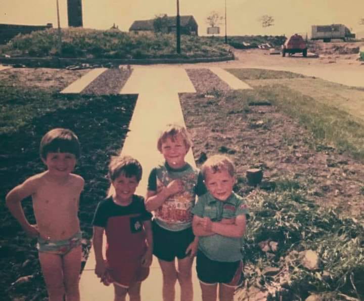
At some point in the early 1970s, the majority of the reservoir was demolished. Only two small pieces of the original structure remained: a bank of earth on the Blue House Road side of the site and a pile of earth, rubble and concrete at the intersection of Mill Lane and Victoria Road West. The photograph below shows Maria Bowman (nee Docherty) standing in her back garden on Blue House Road with the earth bank in the background:

The rest of the reservoir site, now flat, was left to grow over with long grass, rosebay willowherb and cow parsley. It became a favourite place for me and my friends to play. The larger of the two hills had a sloping, grassy side as well as a steep, craggy side of bare earth, and could in our imaginations become a mountain, an alien landscape or a perilous cliff face. The smaller hill had broken pieces of brick wall and concrete piping, and could be an ancient ruined city or a bombed-out war site. We enjoyed endless explorations of these landscapes and the overgrown jungles between them.
Eventually, around 1981, the remainder of the old reservoir was cleared for construction to begin on a new housing estate, St. Joseph’s Court. The first houses were finished in the spring of 1983, and over the next couple of years the area gradually became unrecognisable from how it used to be.
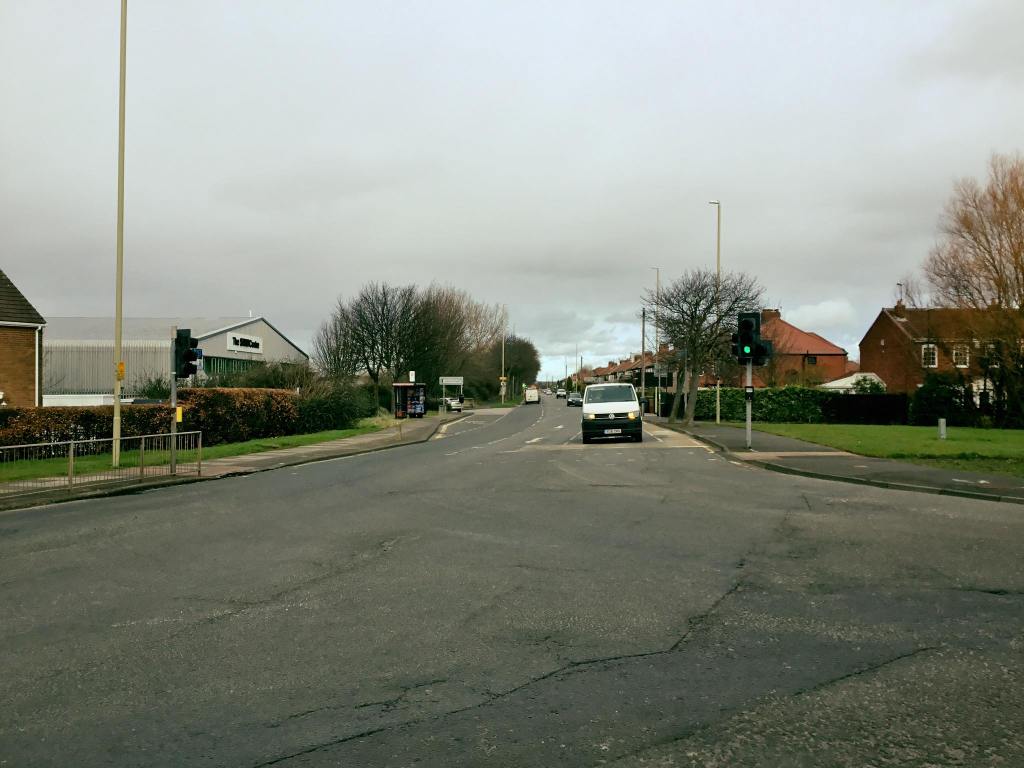
Here is an image looking down Mill Lane from the corner of Victoria Road West. The reservoir would have covered the whole of the green area and St. Joseph’s Court behind the trees.
This photograph from 1950 shows the view down Victoria Road West from the Mill Lane junction. You can see the slope of the Reservoir on the right hand side of the foreground. Across the street is a farmer’s corn field:
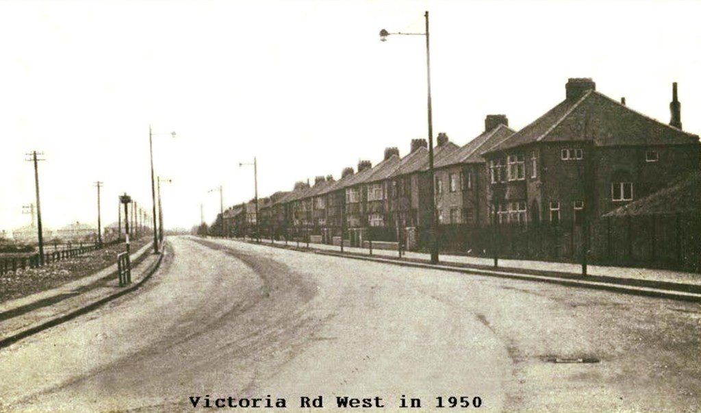
Here is the same view in the present day The reservoir has been replaced by St. Joseph’s Court and the corn field by the Victoria Industrial Estate. It’s amazing to see how much has changed, yet how much has stayed the same.
Allan C and Norman Dunn from the Hebburn and Our Neighbours web forum raised some interesting points about the reservoir, its demolition and the subsequent construction of St. Joseph’s Court:
There must have been detailed plans for the construction and demolition of the reservoir, so these must be on file in an archive somewhere.
Where did the water for the reservoir come from and where was it sent to? Was it treated for human consumption or was it for industrial purposes?
What became of the underground pipe work that fed and emptied the reservoir? Was it re-purposed for something else? Presumably it still exists somewhere under Victoria Road West and/or Mill Lane.
Lastly, if you look at an aerial photograph of St Joseph’s Court:

You can see that the houses are built around the periphery of the reservoir site, where the embankments used to be. This was common practice when building on sites like this one and the old Colliery sites in Hebburn, where there used to be large holes in the ground, for both cost and safety concerns. The houses are built on the areas that are known to be more solid and stable. The rest is grassed over or used for parking spaces and so on.
Do you remember the covered reservoir? Do you have any photographs of it, especially from the early 1970s pre- and post-demolition? If you do I would love to hear from you. Please get in touch via the Comments section on this page.

Leave a comment